
Réservoir de Bouzey topographic map
Interactive map
Click on the map to display elevation.
About this map
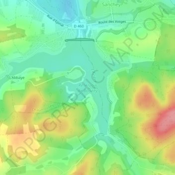
Name: Réservoir de Bouzey topographic map, elevation, terrain.
Average elevation: 389 m
Minimum elevation: 350 m
Maximum elevation: 452 m
Other topographic maps
Click on a map to view its topography, its elevation and its terrain.
L'Abbaye
France > Grand Est > Vosges > Chaumousey
L'Abbaye, Chaumousey, Épinal, Vosges, Grand Est, France métropolitaine, 88390, France
Average elevation: 383 m