
Thank you for supporting this site ❤️
Make a donation
Make a donation
Gear up for your next adventure:
As an Amazon Associate, this site earns from qualifying purchases at no extra cost to you.
Yaha topographic map
Click on the map to display elevation.
Thank you for supporting this site ❤️
Make a donation
Make a donation
Gear up for your next adventure:
As an Amazon Associate, this site earns from qualifying purchases at no extra cost to you.
About this map
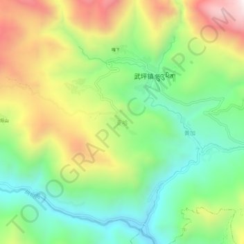
Name: Yaha topographic map, elevation, terrain.
Location: Yaha, Wuping, Zhugqu County, Gannan, Gansu, 746300, China (33.59379 104.31234 33.63379 104.35234)
Average elevation: 2,174 m
Minimum elevation: 1,799 m
Maximum elevation: 2,742 m
Thank you for supporting this site ❤️
Make a donation
Make a donation
Gear up for your next adventure:
As an Amazon Associate, this site earns from qualifying purchases at no extra cost to you.