
Borredà topographic map
Interactive map
Click on the map to display elevation.
About this map
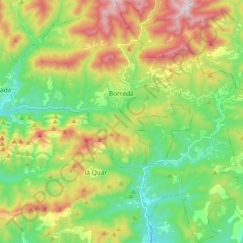
Name: Borredà topographic map, elevation, terrain.
Location: Borredà, Berguedà, Barcelona, 08619, Spanje (42.07738 1.94972 42.17161 2.07024)
Average elevation: 877 m
Minimum elevation: 627 m
Maximum elevation: 1,291 m
Other topographic maps
Click on a map to view its topography, its elevation and its terrain.