
Thank you for supporting this site ❤️
Make a donation
Make a donation
Gear up for your next adventure:
As an Amazon Associate, this site earns from qualifying purchases at no extra cost to you.
Kapkwen topographic map
Click on the map to display elevation.
Thank you for supporting this site ❤️
Make a donation
Make a donation
Gear up for your next adventure:
As an Amazon Associate, this site earns from qualifying purchases at no extra cost to you.
About this map
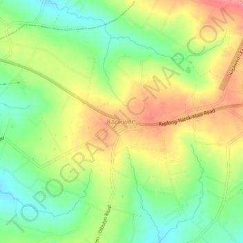
Name: Kapkwen topographic map, elevation, terrain.
Location: Kapkwen, Chepalungu, Bomet, Rift Valley, 20400, Kenya (-0.80612 35.27977 -0.76612 35.31977)
Average elevation: 1,936 m
Minimum elevation: 1,897 m
Maximum elevation: 1,979 m
Thank you for supporting this site ❤️
Make a donation
Make a donation
Gear up for your next adventure:
As an Amazon Associate, this site earns from qualifying purchases at no extra cost to you.