
Thank you for supporting this site ❤️
Make a donation
Make a donation
Gear up for your next adventure:
As an Amazon Associate, this site earns from qualifying purchases at no extra cost to you.
Koşuyolu topographic map
Click on the map to display elevation.
Thank you for supporting this site ❤️
Make a donation
Make a donation
Gear up for your next adventure:
As an Amazon Associate, this site earns from qualifying purchases at no extra cost to you.
About this map
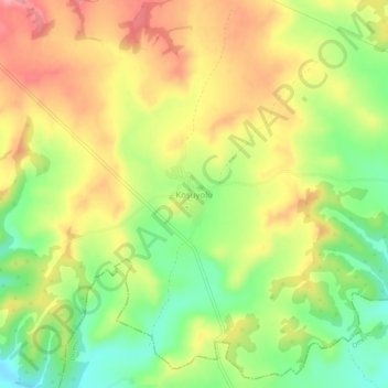
Name: Koşuyolu topographic map, elevation, terrain.
Location: Koşuyolu, Savur, Mardin, Southeastern Anatolia Region, Turkey (37.47068 41.00749 37.51068 41.04749)
Average elevation: 1,092 m
Minimum elevation: 1,032 m
Maximum elevation: 1,150 m
Thank you for supporting this site ❤️
Make a donation
Make a donation
Gear up for your next adventure:
As an Amazon Associate, this site earns from qualifying purchases at no extra cost to you.