
Thank you for supporting this site ❤️
Make a donation
Make a donation
Gear up for your next adventure:
As an Amazon Associate, this site earns from qualifying purchases at no extra cost to you.
Vikasnagar topographic map
Click on the map to display elevation.
Thank you for supporting this site ❤️
Make a donation
Make a donation
Gear up for your next adventure:
As an Amazon Associate, this site earns from qualifying purchases at no extra cost to you.
About this map
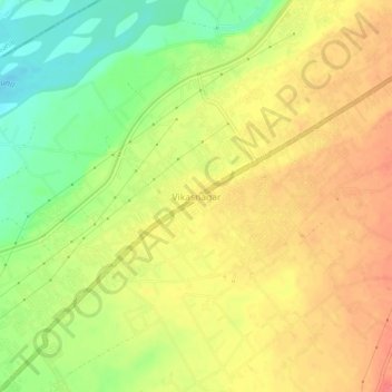
Name: Vikasnagar topographic map, elevation, terrain.
Location: Vikasnagar, Dehradun, Uttarakhand, 248198, India (30.44892 77.75110 30.48892 77.79110)
Average elevation: 462 m
Minimum elevation: 427 m
Maximum elevation: 487 m
Thank you for supporting this site ❤️
Make a donation
Make a donation
Gear up for your next adventure:
As an Amazon Associate, this site earns from qualifying purchases at no extra cost to you.