Geolocate

Silda topographic map

Click on the map to display elevation.

About this map

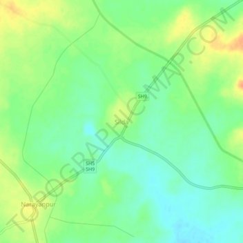
Name: Silda topographic map, elevation, terrain.

Location: Silda, Binpur-II, Jhargram, West Bengal, 721515, India (22.59676 86.79598 22.63676 86.83598)

Average elevation: 107 m

Minimum elevation: 91 m

Maximum elevation: 127 m

Gear up for your next adventure:

🕶️Polarized Sunglasses - Reduces glare from snow and water at high elevations
🧢Hiking Hat - Sun-protective and breathable hats for long treks
🧥Softshell Jacket - Windproof and breathable jacket for hiking
🥾Hiking Gaiters - Protect legs and shoes from mud, snow, and debris
🧤Rechargeable Heated Gloves - Extreme warmth for Canadian winter expeditions

As an Amazon Associate, this site earns from qualifying purchases at no extra cost to you.