Geolocate

Santa Giulia topographic map

Click on the map to display elevation.

About this map

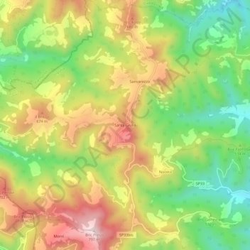
Name: Santa Giulia topographic map, elevation, terrain.

Location: Santa Giulia, Dego, Savona, Liguria, Italy (44.45098 8.21076 44.49098 8.25076)

Average elevation: 550 m

Minimum elevation: 335 m

Maximum elevation: 791 m

Gear up for your next adventure:

🕶️Polarized Sunglasses - Protect your eyes with durable polarized lenses
🧥Waterproof Hiking Jacket - Protect yourself from rain and wind while hiking
🪑Insulated Seat Pad - Protect your seat from cold rocks and wet logs
🎒Hiking Backpack - Lightweight and ergonomic backpacks for day hikes or multi-day treks
🧰Emergency Multi-Tool - Compact multi-tool for outdoor survival

As an Amazon Associate, this site earns from qualifying purchases at no extra cost to you.