
Make a donation
Gear up for your next adventure:
As an Amazon Associate, this site earns from qualifying purchases at no extra cost to you.
Castle Ewen topographic map
Click on the map to display elevation.
Make a donation
Gear up for your next adventure:
As an Amazon Associate, this site earns from qualifying purchases at no extra cost to you.
About this map
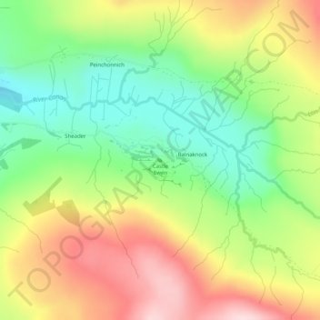
Name: Castle Ewen topographic map, elevation, terrain.
Average elevation: 170 m
Minimum elevation: 39 m
Maximum elevation: 330 m
Make a donation
Gear up for your next adventure:
As an Amazon Associate, this site earns from qualifying purchases at no extra cost to you.
Other topographic maps
Click on a map to view its topography, its elevation and its terrain.
Skye
Vereinigtes Königreich > Schottland > Highland
Sleat (schottisch-gälisch: Sléibhte oder Slèite) ist eine Halbinsel im Süden von Skye. Sie ist durch den Sound of Sleat vom Festland getrennt. Der ursprüngliche schottisch-gälische Name bedeutet so viel wie „Ebene“, was aber nicht der topografischen Realität entspricht. Die Halbinsel, die auch als…
Average elevation: 63 m
Ardnamurchan
Vereinigtes Königreich > Schottland > Highland
Die Herkunft des Namens Ardnamurchan ist umstritten. Zwei Bedeutungen erscheinen am wahrscheinlichsten. Abgesehen vom schottisch-gälischen Wort Àirde (deutsch: Stelle oder Höhe) bezieht sich eine Deutung auf murchan bzw. Muirchu (deutsch: Seehund oder Otter), also etwa „Stelle der Seehunde“. Die andere…
Average elevation: 73 m
Make a donation
Gear up for your next adventure:
As an Amazon Associate, this site earns from qualifying purchases at no extra cost to you.