
Thank you for supporting this site ❤️
Make a donation
Make a donation
Gear up for your next adventure:
As an Amazon Associate, this site earns from qualifying purchases at no extra cost to you.
Matibamba topographic map
Click on the map to display elevation.
Thank you for supporting this site ❤️
Make a donation
Make a donation
Gear up for your next adventure:
As an Amazon Associate, this site earns from qualifying purchases at no extra cost to you.
About this map
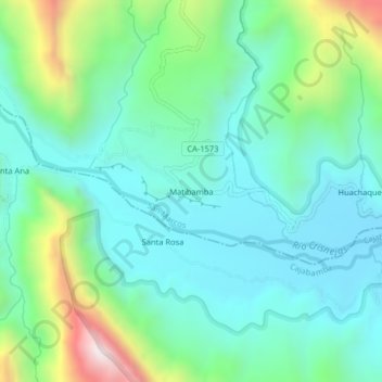
Name: Matibamba topographic map, elevation, terrain.
Location: Matibamba, José Sabogal, San Marcos, Cajamarca, Perú (-7.37666 -77.91561 -7.33666 -77.87561)
Average elevation: 1,330 m
Minimum elevation: 1,107 m
Maximum elevation: 2,011 m
Thank you for supporting this site ❤️
Make a donation
Make a donation
Gear up for your next adventure:
As an Amazon Associate, this site earns from qualifying purchases at no extra cost to you.