
Thank you for supporting this site ❤️
Make a donation
Make a donation
Gear up for your next adventure:
As an Amazon Associate, this site earns from qualifying purchases at no extra cost to you.
Penacio topographic map
Click on the map to display elevation.
Thank you for supporting this site ❤️
Make a donation
Make a donation
Gear up for your next adventure:
As an Amazon Associate, this site earns from qualifying purchases at no extra cost to you.
About this map
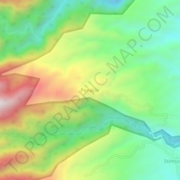
Name: Penacio topographic map, elevation, terrain.
Location: Penacio, Misamis Occidental, Northern Mindanao, Philippines (8.19239 123.68456 8.23239 123.72456)
Average elevation: 723 m
Minimum elevation: 384 m
Maximum elevation: 1,265 m
Thank you for supporting this site ❤️
Make a donation
Make a donation
Gear up for your next adventure:
As an Amazon Associate, this site earns from qualifying purchases at no extra cost to you.