Geolocate

Pati topographic map

Click on the map to display elevation.

About this map

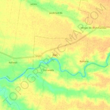
Name: Pati topographic map, elevation, terrain.

Location: Pati, Akola, Maharashtra, 444111, India (20.82689 77.03281 20.90689 77.11281)

Average elevation: 261 m

Minimum elevation: 242 m

Maximum elevation: 270 m

Gear up for your next adventure:

🥾Waterproof Hiking Boots - Essential footwear for rugged terrain and wet Canadian trails
🛶Waterproof Dry Bags - Keep electronics and clothes dry during river crossings
🎒Hiking Backpack - Lightweight and ergonomic backpacks for day hikes or multi-day treks
🔭Compact Monocular - One-handed bird watching and trail spotting
🧦Crew Hiking Socks - Comfortable socks for long-distance hikes

As an Amazon Associate, this site earns from qualifying purchases at no extra cost to you.