Geolocate

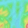
Lac aux Rognons topographic map

Click on the map to display elevation.

About this map

Name: Lac aux Rognons topographic map, elevation, terrain.

Location: Lac aux Rognons, Lac-Croche, La Jacques-Cartier, Capitale-Nationale, Québec, Canada (47.49658 -71.75384 47.53015 -71.72798)

Average elevation: 637 m

Minimum elevation: 586 m

Maximum elevation: 778 m

Other topographic maps

Click on a map to view its topography, its elevation and its terrain.

Lac Sioui

Canada > Québec > La Jacques-Cartier > Lac-Croche

Average elevation: 711 m

Lac Brûlé

Canada > Québec > La Jacques-Cartier > Lac-Croche

Average elevation: 530 m

Le Scotora

Canada > Québec > La Jacques-Cartier > Lac-Croche

Average elevation: 551 m

Gear up for your next adventure:

💡Solar Camping Lamp - Eco-friendly lighting for campsites
🥾Trail Running Shoes - Lightweight and durable shoes for trail running
🚲Heavy Duty Bike Lock - Secure your bike at the trailhead or during stops
🥾Hiking Boots - Sturdy boots providing ankle support and traction on rugged trails
🛌Down Sleeping Bag - Superior warmth-to-weight ratio for cold nights

As an Amazon Associate, this site earns from qualifying purchases at no extra cost to you.