Geolocate

Testaccio topographic map

Click on the map to display elevation.

About this map

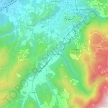
Name: Testaccio topographic map, elevation, terrain.

Location: Testaccio, Spoleto, Perugia, Umbria, 06049, Italy (42.70131 12.71031 42.74131 12.75031)

Average elevation: 512 m

Minimum elevation: 286 m

Maximum elevation: 985 m

Gear up for your next adventure:

💡Compact LED Flashlight - Powerful and portable flashlight for outdoor use
🥾Approach Boots - Comfortable boots for hiking and climbing approaches
🧊Portable Cooler - Keep food and drinks cold during outdoor adventures
🥾Trail Running Shoes - Lightweight and durable shoes for trail running
🚲Handlebar Phone Mount - View topographic-map.com live while cycling

As an Amazon Associate, this site earns from qualifying purchases at no extra cost to you.