Geolocate

Quicho topographic map

Click on the map to display elevation.

About this map

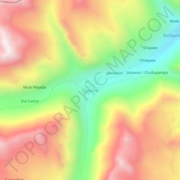
Name: Quicho topographic map, elevation, terrain.

Location: Quicho, Ollachea, Carabaya, Puno, Perú (-13.70086 -70.66746 -13.66086 -70.62746)

Average elevation: 4,196 m

Minimum elevation: 3,704 m

Maximum elevation: 4,658 m

Gear up for your next adventure:

🧦Merino Wool Socks - Moisture-wicking comfort for long-distance hiking
🗺️Topographic Maps - Detailed maps to explore trails, mountains, and wilderness areas
Camping Essentials - All-in-one gear for a comfortable camping trip
Camping Coffee Maker - Brew fresh coffee anywhere on the topographic map
Backpacking Tent - Lightweight tent for long-distance hiking trips

As an Amazon Associate, this site earns from qualifying purchases at no extra cost to you.