Geolocate

Cunico topographic map

Click on the map to display elevation.

About this map

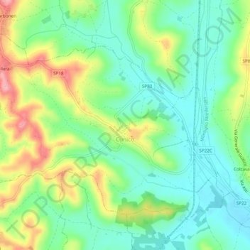
Name: Cunico topographic map, elevation, terrain.

Location: Cunico, Asti, Piemont, Italy (45.02936 8.06777 45.05439 8.11575)

Average elevation: 215 m

Minimum elevation: 167 m

Maximum elevation: 302 m

Gear up for your next adventure:

🥽Outdoor Goggles - Protective eyewear for outdoor activities
🥾Hiking Gaiters - Protect legs and shoes from mud, snow, and debris
🛌Insulated Sleeping Pad - Critical thermal barrier between you and the cold ground
🧢Outdoor Cap - Protective cap for sun and rain during hikes
🧥Ultralight Puffy Jacket - Maximum warmth that packs down to the size of an orange

As an Amazon Associate, this site earns from qualifying purchases at no extra cost to you.