Geolocate

Canitz topographic map

Click on the map to display elevation.

About this map

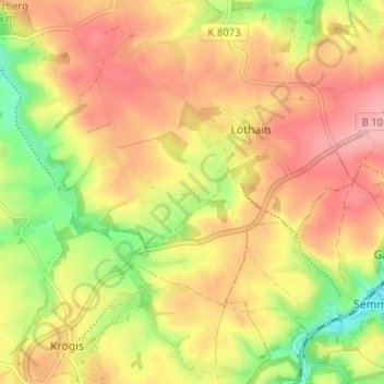
Name: Canitz topographic map, elevation, terrain.

Location: Canitz, Löthain, Käbschütztal, Meißen, Sachsen, Deutschland (51.11649 13.38062 51.15649 13.42062)

Average elevation: 208 m

Minimum elevation: 146 m

Maximum elevation: 253 m

Gear up for your next adventure:

🧦Hiking Liner Socks - Thin base layer to prevent friction and blisters
🧦Thermal Socks - Warm socks for winter hiking or camping
🥾Approach Boots - Comfortable boots for hiking and climbing approaches
💡Solar Camping Lamp - Eco-friendly lighting for campsites
🥾Durable Hiking Shoes - Long-lasting shoes for frequent hiking

As an Amazon Associate, this site earns from qualifying purchases at no extra cost to you.