Geolocate

Butong topographic map

Click on the map to display elevation.

About this map

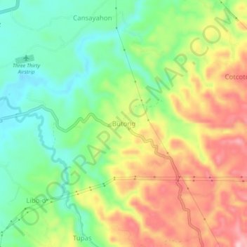
Name: Butong topographic map, elevation, terrain.

Location: Butong, Ronda, Cebu, Central Visayas, 6034, Philippines (9.98057 123.41848 10.02057 123.45848)

Average elevation: 87 m

Minimum elevation: 2 m

Maximum elevation: 197 m

Gear up for your next adventure:

🧤Thermal Hiking Gloves - Grip-enhanced gloves for cold-weather altitude trekking
🗺️Topographic Maps - Detailed maps to explore trails, mountains, and wilderness areas
🦶Anti-Blister Balm - Prevents friction and hotspots during long ascents
🧥Waterproof Pants - Keep dry during rainy hiking conditions
💡LED Camping Lantern - Illuminate your campsite with long-lasting lanterns

As an Amazon Associate, this site earns from qualifying purchases at no extra cost to you.