Geolocate

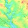
Lisloc topographic map

Click on the map to display elevation.

About this map

Name: Lisloc topographic map, elevation, terrain.

Location: Lisloc, Muzillac, Vannes, Morbihan, Bretagne, France métropolitaine, 56190, France (47.52355 -2.47642 47.56355 -2.43642)

Average elevation: 25 m

Minimum elevation: -2 m

Maximum elevation: 60 m

Other topographic maps

Click on a map to view its topography, its elevation and its terrain.
56190

France > Bretagne > Morbihan > Muzillac

Average elevation: 26 m

Gear up for your next adventure:

📷Outdoor Action Camera - Capture high-elevation views and rugged adventures
🪜Heavy Duty Carabiners - Multi-use clips for securing gear to your backpack
🧥Insulated Jacket - Keep warm in cold outdoor conditions
🥾Waterproof Hiking Boots - Essential footwear for rugged terrain and wet Canadian trails
🥫Freeze-Dried Meals - Lightweight, high-calorie nutrition for multi-day treks

As an Amazon Associate, this site earns from qualifying purchases at no extra cost to you.