
Make a donation
Gear up for your next adventure:
As an Amazon Associate, this site earns from qualifying purchases at no extra cost to you.
Ötlisberg topographic map
Click on the map to display elevation.
Make a donation
Gear up for your next adventure:
As an Amazon Associate, this site earns from qualifying purchases at no extra cost to you.
Ötlisberg
Öschbrig (also known as Oetlisberg) with an elevation of 696 metres (2,283 ft), is a wooded mountain in Switzerland overlooking to the east Zürichsee (Lake Zürich).
Make a donation
Gear up for your next adventure:
As an Amazon Associate, this site earns from qualifying purchases at no extra cost to you.
About this map
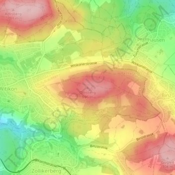
Name: Ötlisberg topographic map, elevation, terrain.
Location: Ötlisberg, Zurich, District Zurich, Zurich, 8125, Switzerland (47.35845 8.60874 47.35855 8.60884)
Average elevation: 626 m
Minimum elevation: 525 m
Maximum elevation: 707 m
Make a donation
Gear up for your next adventure:
As an Amazon Associate, this site earns from qualifying purchases at no extra cost to you.
Other topographic maps
Click on a map to view its topography, its elevation and its terrain.