Geolocate

Sankh topographic map

Click on the map to display elevation.

About this map

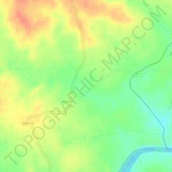
Name: Sankh topographic map, elevation, terrain.

Location: Sankh, Chand Tahsil, Chhindwara, Madhya Pradesh, India (21.95355 79.30171 21.97274 79.32762)

Average elevation: 552 m

Minimum elevation: 524 m

Maximum elevation: 574 m

Gear up for your next adventure:

🍽️Titanium Camping Spork - Ultralight and indestructible eating utensil
🧭Orienteering Kit - Tools for map reading and navigation in the wild
🧴First Aid Kit - Essential first aid supplies for outdoor emergencies
🥾Waterproof Hiking Boots - Boots keeping your feet dry in wet conditions
🔋Emergency Crank Radio - Weather alerts and power without needing batteries

As an Amazon Associate, this site earns from qualifying purchases at no extra cost to you.