Geolocate

Saluni topographic map

Click on the map to display elevation.

About this map

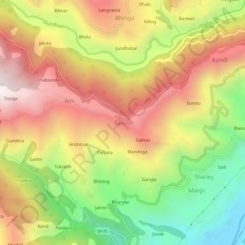
Name: Saluni topographic map, elevation, terrain.

Location: Saluni, Chamba, Himachal Pradesh, 176320, India (32.70041 76.03221 32.74041 76.07221)

Average elevation: 1,389 m

Minimum elevation: 782 m

Maximum elevation: 1,956 m

Gear up for your next adventure:

🥾Waterproof Trail Shoes - Shoes designed to handle wet terrain
🧥Packable Rain Jacket - Breathable waterproof layer for unpredictable weather
🌬️Windproof Camp Stove - Efficient cooking even on exposed mountain peaks
🦶Hiking Shoe Insoles - Added support for high arches and long days on feet
📷Outdoor Action Camera - Capture high-elevation views and rugged adventures

As an Amazon Associate, this site earns from qualifying purchases at no extra cost to you.