Geolocate

Tecoman topographic map

Click on the map to display elevation.

About this map

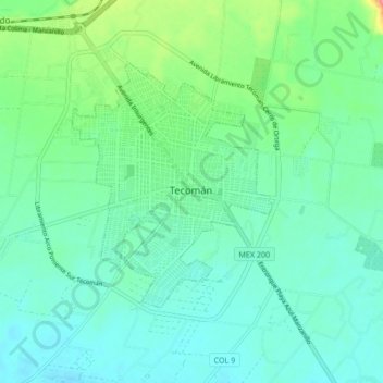
Name: Tecoman topographic map, elevation, terrain.

Location: Tecoman, Tecomán, Colima, 28734, Mexico (18.75092 -104.03341 19.07092 -103.71341)

Average elevation: 129 m

Minimum elevation: -2 m

Maximum elevation: 1,286 m

Other topographic maps

Click on a map to view its topography, its elevation and its terrain.

Socorro Island

Mexico > Colima > Tecomán

Average elevation: 149 m

Socorro Island

Mexico > Colima > Tecomán

Average elevation: 149 m

Gear up for your next adventure:

🛌Insulated Sleeping Pad - Critical thermal barrier between you and the cold ground
🦟Insect Repellent - Keep mosquitoes and black flies away in wooded areas
🧭GPS Outdoor Watch - Smart watch for navigation and fitness tracking in nature
🚑Survival Whistle - Signal for help across long distances in mountains
🥾Mountain Trail Shoes - High-traction shoes for mountain trails

As an Amazon Associate, this site earns from qualifying purchases at no extra cost to you.