
Thank you for supporting this site ❤️
Make a donation
Make a donation
Gear up for your next adventure:
As an Amazon Associate, this site earns from qualifying purchases at no extra cost to you.
Radomlje topographic map
Click on the map to display elevation.
Thank you for supporting this site ❤️
Make a donation
Make a donation
Gear up for your next adventure:
As an Amazon Associate, this site earns from qualifying purchases at no extra cost to you.
About this map
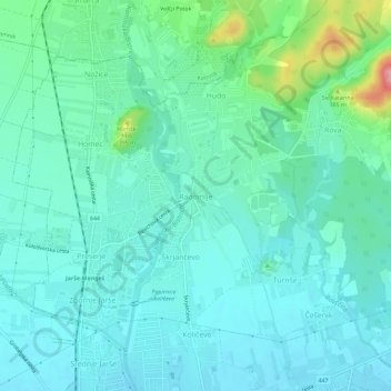
Name: Radomlje topographic map, elevation, terrain.
Location: Radomlje, Domžale, Upravna Enota Domžale, 1235, Slovenia (46.15319 14.59018 46.19319 14.63018)
Average elevation: 333 m
Minimum elevation: 306 m
Maximum elevation: 446 m
Thank you for supporting this site ❤️
Make a donation
Make a donation
Gear up for your next adventure:
As an Amazon Associate, this site earns from qualifying purchases at no extra cost to you.