Geolocate

Najem topographic map

Click on the map to display elevation.

About this map

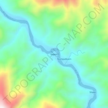
Name: Najem topographic map, elevation, terrain.

Location: Najem, Aramango, Bagua, Amazonas, Perú (-5.28196 -78.46096 -5.24196 -78.42096)

Average elevation: 519 m

Minimum elevation: 306 m

Maximum elevation: 1,062 m

Gear up for your next adventure:

🥾Approach Shoes - Shoes designed for climbing approaches and rugged trails
Lightweight Camping Tent - Portable shelter optimized for Canadian backcountry camping
🔦LED Headtorch - Bright and durable light for night activities
🧥Softshell Hiking Jacket - The perfect balance of wind protection and breathability
Camping Groundsheet - Protect your tent from moisture and dirt

As an Amazon Associate, this site earns from qualifying purchases at no extra cost to you.