
Wigry topographic map
Interactive map
Click on the map to display elevation.
About this map
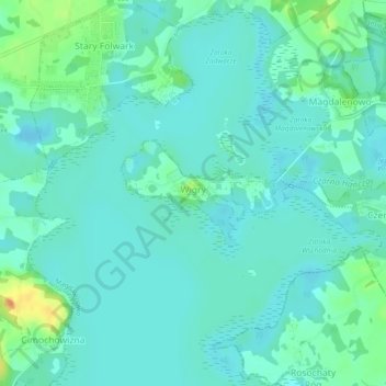
Name: Wigry topographic map, elevation, terrain.
Average elevation: 132 m
Minimum elevation: 122 m
Maximum elevation: 165 m
Other topographic maps
Click on a map to view its topography, its elevation and its terrain.
Szurpiły
Poland > Podlaskie Voivodeship > Suwałki County
Szurpiły, gmina Jeleniewo, Suwałki County, Podlaskie Voivodeship, Poland
Average elevation: 216 m