Geolocate

Ingenbohl topographic map

Click on the map to display elevation.

About this map

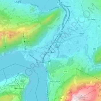
Name: Ingenbohl topographic map, elevation, terrain.

Location: Ingenbohl, Schwyz, 6440, Switzerland (46.98233 8.54903 47.02105 8.64196)

Average elevation: 674 m

Minimum elevation: 414 m

Maximum elevation: 1,893 m

Other topographic maps

Click on a map to view its topography, its elevation and its terrain.

Goldau

Switzerland > Schwyz > Schwyz

Average elevation: 856 m

Gear up for your next adventure:

Camping Groundsheet - Protect your tent from moisture and dirt
💧Collapsible Water Bottle - Space-saving water bottle for outdoor activities
🎒Hiking Daypack - Lightweight and durable backpacks for day trips and excursions
🧢Hiking Hat - Sun-protective and breathable hats for long treks
🚲Heavy Duty Bike Lock - Secure your bike at the trailhead or during stops

As an Amazon Associate, this site earns from qualifying purchases at no extra cost to you.