Geolocate

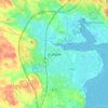
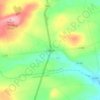
Termonfeckin topographic map

Click on the map to display elevation.

About this map

Name: Termonfeckin topographic map, elevation, terrain.

Location: Termonfeckin, Termonfeckin ED, The Borough District of Drogheda, County Louth, Leinster, Ireland (53.74904 -6.28252 53.76797 -6.25559)

Average elevation: 16 m

Minimum elevation: -3 m

Maximum elevation: 41 m

Other topographic maps

Click on a map to view its topography, its elevation and its terrain.
Carlingford

Ireland > County Louth > Carlingford

Average elevation: 84 m

Dundalk

Ireland > County Louth > Dundalk

Average elevation: 16 m

Drogheda

Ireland > County Louth > Drogheda

Average elevation: 38 m

Blackrock

Ireland > County Louth

Average elevation: 5 m

Dromiskin

Ireland > County Louth > Dromiskin

Average elevation: 8 m

Collon

Ireland > County Louth > Collon

Average elevation: 146 m

Brookville Park

Ireland > County Louth

Average elevation: 26 m

Louth

Ireland > County Louth

Average elevation: 34 m

Tullyallen

Ireland > County Louth

Average elevation: 64 m

Slieve Foye

Ireland > County Louth

Average elevation: 287 m

Ravensdale

Ireland > County Louth

Average elevation: 124 m

Gear up for your next adventure:

🧴Waterproofing Spray - Restore the DWR coating on jackets and tents
🥾Hiking Leggings - Comfortable leggings for outdoor activities
🥾Light Trekking Boots - Supportive boots for multi-day treks
🚲Handlebar Phone Mount - View topographic-map.com live while cycling
🧴Outdoor Sunscreen - High SPF protection for high-altitude UV exposure

As an Amazon Associate, this site earns from qualifying purchases at no extra cost to you.