Geolocate

Charnay topographic map

Click on the map to display elevation.

About this map
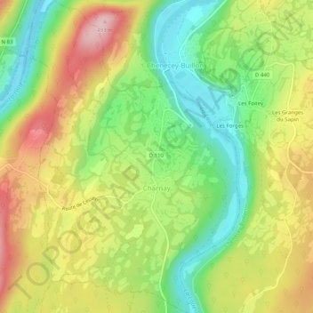
Name: Charnay topographic map, elevation, terrain.

Location: Charnay, Besançon, Doubs, Bourgogne – Franche-Comté, Metropolitan France, 25440, France (47.11304 5.93594 47.14683 5.96879)

Average elevation: 369 m

Minimum elevation: 269 m

Maximum elevation: 488 m

Other topographic maps

Click on a map to view its topography, its elevation and its terrain.
Gear up for your next adventure:

🥾Trail Hiking Socks - Comfortable socks to prevent blisters and fatigue
🧶550 Survival Paracord - Versatile utility cord for emergency repairs and rigging
🥾Hiking Leggings - Comfortable leggings for outdoor activities
🚲Handlebar Phone Mount - View topographic-map.com live while cycling
🦟Insect Repellent - Keep mosquitoes and black flies away in wooded areas

As an Amazon Associate, this site earns from qualifying purchases at no extra cost to you.