
Make a donation
Gear up for your next adventure:
As an Amazon Associate, this site earns from qualifying purchases at no extra cost to you.
Miane topographic map
Click on the map to display elevation.
Make a donation
Gear up for your next adventure:
As an Amazon Associate, this site earns from qualifying purchases at no extra cost to you.
Miane
Miane ist eine italienische Gemeinde im Nordosten Italiens in der Provinz Treviso und der Region Venetien mit 3144 Einwohnern (Stand 31. Dezember 2022). Das Gemeindegebiet erstreckt sich über eine Höhe von 163 m bis zu 1464 m s.l.m.
Make a donation
Gear up for your next adventure:
As an Amazon Associate, this site earns from qualifying purchases at no extra cost to you.
About this map
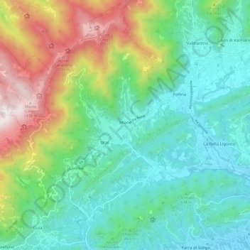
Name: Miane topographic map, elevation, terrain.
Location: Miane, Treviso, Venetien, Italien (45.90455 12.03837 45.98234 12.13684)
Average elevation: 528 m
Minimum elevation: 145 m
Maximum elevation: 1,478 m
Make a donation
Gear up for your next adventure:
As an Amazon Associate, this site earns from qualifying purchases at no extra cost to you.
Other topographic maps
Click on a map to view its topography, its elevation and its terrain.
Monte Grappa
Die SP148 verbindet Caupo im Norden mit Romano d’Ezzelino im Süden und weist eine maximale Höhe von rund 1600 Metern auf. Sie verläuft westlich des Gipfels. Die Nordauffahrt ist 29,6 Kilometer lang und steigt durchschnittlich 4,8 % an, wobei sich speziell in der zweiten Hälfte kurze Abfahrten mit steilen…
Average elevation: 1,502 m
Make a donation
Gear up for your next adventure:
As an Amazon Associate, this site earns from qualifying purchases at no extra cost to you.