Geolocate

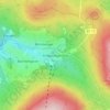
Bischofsgrüner Forst topographic map

Click on the map to display elevation.

About this map

Name: Bischofsgrüner Forst topographic map, elevation, terrain.

Location: Bischofsgrüner Forst, Landkreis Bayreuth, Bavaria, Germany (50.02498 11.72299 50.09546 11.84891)

Average elevation: 753 m

Minimum elevation: 568 m

Maximum elevation: 1,046 m

Other topographic maps

Click on a map to view its topography, its elevation and its terrain.
Plösen

Germany > Bavaria > Landkreis Bayreuth

Average elevation: 449 m

Spies

Germany > Bavaria > Landkreis Bayreuth > Betzenstein

Average elevation: 534 m

Pfarrhügel

Germany > Bavaria > Landkreis Bayreuth > Eckersdorf

Average elevation: 507 m

Meinberg

Germany > Bavaria > Landkreis Bayreuth > Goldkronach

Average elevation: 450 m

Gottelhof

Germany > Bavaria > Landkreis Bayreuth > Hollfeld

Average elevation: 407 m

Reizendorf

Germany > Bavaria > Landkreis Bayreuth > Ahorntal

Average elevation: 435 m

Röhrig

Germany > Bavaria > Landkreis Bayreuth > Bindlacher Berg

Average elevation: 410 m

Gear up for your next adventure:

🧤Insulated Winter Gloves - Heavy-duty protection for sub-zero Canadian adventures
🔪Outdoor Multitool - Versatile tool for repairs and food prep in the wild
🥤Collapsible Travel Cup - Saves space and weight in your mess kit
🛌Insulated Sleeping Pad - Critical thermal barrier between you and the cold ground
🥾Hiking Gaiters - Protect legs and shoes from mud, snow, and debris

As an Amazon Associate, this site earns from qualifying purchases at no extra cost to you.