
Thank you for supporting this site ❤️
Make a donation
Make a donation
Gear up for your next adventure:
As an Amazon Associate, this site earns from qualifying purchases at no extra cost to you.
Bardenbach topographic map
Click on the map to display elevation.
Thank you for supporting this site ❤️
Make a donation
Make a donation
Gear up for your next adventure:
As an Amazon Associate, this site earns from qualifying purchases at no extra cost to you.
About this map
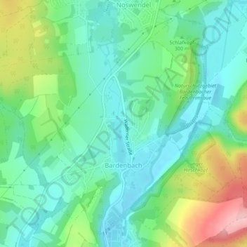
Name: Bardenbach topographic map, elevation, terrain.
Location: Bardenbach, Wadern, Landkreis Merzig-Wadern, Saarland, Germany (49.50008 6.84554 49.52338 6.88409)
Average elevation: 296 m
Minimum elevation: 249 m
Maximum elevation: 406 m
Thank you for supporting this site ❤️
Make a donation
Make a donation
Gear up for your next adventure:
As an Amazon Associate, this site earns from qualifying purchases at no extra cost to you.