Geolocate

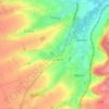
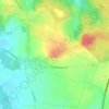
Estrée-Blanche topographic map

Click on the map to display elevation.

About this map

Name: Estrée-Blanche topographic map, elevation, terrain.

Location: Estrée-Blanche, Béthune, Pas-de-Calais, Hauts-de-France, Metropolitan France, 62145, France (50.57775 2.30080 50.60902 2.34408)

Average elevation: 72 m

Minimum elevation: 36 m

Maximum elevation: 102 m

Other topographic maps

Click on a map to view its topography, its elevation and its terrain.

Panehem

France > Hauts-de-France > Pas-de-Calais > Samer

Average elevation: 70 m

Le Petit Vimy

France > Hauts-de-France > Pas-de-Calais > Vimy

Average elevation: 93 m

Noyelles

France > Hauts-de-France > Pas-de-Calais > Bours

Average elevation: 125 m

Gear up for your next adventure:

🧭GPS Tracker - Track your location in remote areas safely
🥾Hiking Boots - Sturdy boots providing ankle support and traction on rugged trails
👟Leg Gaiters - Keep debris, mud, and snow out of your boots
🍽️Titanium Camping Spork - Ultralight and indestructible eating utensil
🧭Orienteering Kit - Tools for map reading and navigation in the wild

As an Amazon Associate, this site earns from qualifying purchases at no extra cost to you.