Geolocate

Los Dragos topographic map

Click on the map to display elevation.

About this map

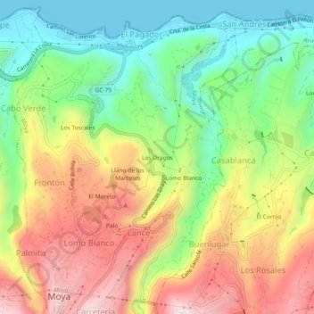
Name: Los Dragos topographic map, elevation, terrain.

Location: Los Dragos, Moya, Las Palmas, Canary Islands, 35432, Spain (28.10845 -15.58901 28.14845 -15.54901)

Average elevation: 231 m

Minimum elevation: 0 m

Maximum elevation: 519 m

Gear up for your next adventure:

🥾Hiking Shoes - Durable and comfortable shoes for trail hiking
🛶Kayak Dry Bag - Waterproof storage for kayaking adventures
🧼Travel Hand Sanitizer - Keep hands clean when water is scarce
🧴Insect Repellent - Protect yourself from bugs during outdoor adventures
🌬️Windproof Camp Stove - Efficient cooking even on exposed mountain peaks

As an Amazon Associate, this site earns from qualifying purchases at no extra cost to you.