Geolocate

Frances topographic map

Click on the map to display elevation.

About this map

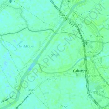
Name: Frances topographic map, elevation, terrain.

Location: Frances, Calumpit, Bulacan, Central Luzon, 3003, Philippines (14.90108 120.73389 14.94108 120.77389)

Average elevation: 4 m

Minimum elevation: -1 m

Maximum elevation: 7 m

Gear up for your next adventure:

🧤Rechargeable Heated Gloves - Extreme warmth for Canadian winter expeditions
🧥Ultralight Puffy Jacket - Maximum warmth that packs down to the size of an orange
🧥Waterproof Pants - Keep dry during rainy hiking conditions
🧴Insect Repellent - Protect yourself from bugs during outdoor adventures
🥾Trail Hiking Socks - Comfortable socks to prevent blisters and fatigue

As an Amazon Associate, this site earns from qualifying purchases at no extra cost to you.