Geolocate

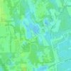
Sugar Mill Estates topographic map

Click on the map to display elevation.

About this map

Name: Sugar Mill Estates topographic map, elevation, terrain.

Location: Sugar Mill Estates, New Smyrna Beach, Volusia County, Florida, 32168, United States (29.02387 -81.00256 29.06387 -80.96256)

Average elevation: 7 m

Minimum elevation: -2 m

Maximum elevation: 14 m

Other topographic maps

Click on a map to view its topography, its elevation and its terrain.
Gear up for your next adventure:

🦶Hiking Shoe Insoles - Added support for high arches and long days on feet
🔭Compact Monocular - One-handed bird watching and trail spotting
💡Solar Camping Lamp - Eco-friendly lighting for campsites
🥾Approach Shoes - Shoes designed for climbing approaches and rugged trails
🧥Ultralight Puffy Jacket - Maximum warmth that packs down to the size of an orange

As an Amazon Associate, this site earns from qualifying purchases at no extra cost to you.