Geolocate

La Virginia topographic map

Click on the map to display elevation.

About this map

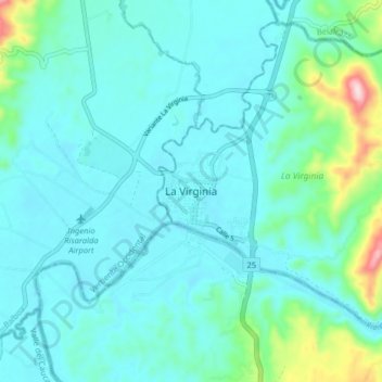
Name: La Virginia topographic map, elevation, terrain.

Location: La Virginia, Risaralda, NO, Colombia (4.85960 -75.92257 4.93960 -75.84257)

Average elevation: 939 m

Minimum elevation: 885 m

Maximum elevation: 1,240 m

Gear up for your next adventure:

🥾Approach Shoes - Shoes designed for climbing approaches and rugged trails
🧥Packable Rain Jacket - Breathable waterproof layer for unpredictable weather
🧢Sun Hat - Wide-brim hat for sun protection
🪑Insulated Seat Pad - Protect your seat from cold rocks and wet logs
🥾Waterproof Hiking Shoes - Durable shoes for wet and rugged trails

As an Amazon Associate, this site earns from qualifying purchases at no extra cost to you.