Geolocate

Bluff Hill topographic map

Click on the map to display elevation.

About this map
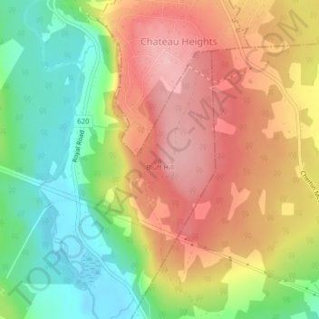
Name: Bluff Hill topographic map, elevation, terrain.

Location: Bluff Hill, Douglas Parish, City of Fredericton, York County, New Brunswick, E3A 6M9, Canada (46.01069 -66.68669 46.01079 -66.68659)

Average elevation: 95 m

Minimum elevation: 9 m

Maximum elevation: 172 m

Other topographic maps

Click on a map to view its topography, its elevation and its terrain.

Gear up for your next adventure:

🥾Hiking Boots - Sturdy boots providing ankle support and traction on rugged trails
🥾Trail Hiking Boots - Supportive boots for rough trails
🔪Outdoor Multitool - Versatile tool for repairs and food prep in the wild
🧤Insulated Winter Gloves - Heavy-duty protection for sub-zero Canadian adventures
🧦Thermal Socks - Warm socks for winter hiking or camping

As an Amazon Associate, this site earns from qualifying purchases at no extra cost to you.