
Thank you for supporting this site ❤️
Make a donation
Make a donation
Gear up for your next adventure:
As an Amazon Associate, this site earns from qualifying purchases at no extra cost to you.
Oostrozebeke topographic map
Click on the map to display elevation.
Thank you for supporting this site ❤️
Make a donation
Make a donation
Gear up for your next adventure:
As an Amazon Associate, this site earns from qualifying purchases at no extra cost to you.
About this map
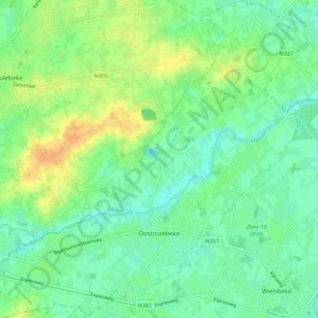
Name: Oostrozebeke topographic map, elevation, terrain.
Location: Oostrozebeke, Tielt, West Flanders, Flanders, 8780, Belgium (50.90428 3.28612 50.96439 3.37625)
Average elevation: 17 m
Minimum elevation: 5 m
Maximum elevation: 36 m
Thank you for supporting this site ❤️
Make a donation
Make a donation
Gear up for your next adventure:
As an Amazon Associate, this site earns from qualifying purchases at no extra cost to you.