Geolocate

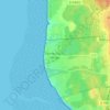
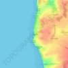
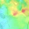
Le Portel topographic map

Click on the map to display elevation.

About this map

Name: Le Portel topographic map, elevation, terrain.

Location: Le Portel, Boulogne-sur-Mer, Pas-de-Calais, Hauts-de-France, Metropolitan France, 62480, France (50.69103 1.56078 50.72821 1.59183)

Average elevation: 21 m

Minimum elevation: -1 m

Maximum elevation: 94 m

Other topographic maps

Click on a map to view its topography, its elevation and its terrain.

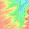
Panehem

France > Hauts-de-France > Pas-de-Calais > Samer

Average elevation: 70 m

Le Petit Vimy

France > Hauts-de-France > Pas-de-Calais > Vimy

Average elevation: 93 m

Noyelles

France > Hauts-de-France > Pas-de-Calais > Bours

Average elevation: 125 m

Gear up for your next adventure:

🔦LED Headlamp - Hands-free lighting for early morning starts or late finishes
🧢Hiking Sun Hat - Wide-brimmed protection for exposed mountain ridges
💧Hydration Bladder - Hands-free hydration solution for long treks
👖Convertible Hiking Pants - Zip-off legs to adapt to changing weather conditions
🧥Fleece Jacket - Warm and lightweight jacket for layering

As an Amazon Associate, this site earns from qualifying purchases at no extra cost to you.