Geolocate

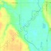
Templeton topographic map

Click on the map to display elevation.

About this map

Name: Templeton topographic map, elevation, terrain.

Location: Templeton, Eden Township, Carroll County, Iowa, United States (41.91087 -94.94853 41.92445 -94.93466)

Average elevation: 434 m

Minimum elevation: 407 m

Maximum elevation: 455 m

Other topographic maps

Click on a map to view its topography, its elevation and its terrain.
Elk Run

United States > Iowa > Carroll County

Average elevation: 336 m

Gear up for your next adventure:

❄️Traction Ice Cleats - Slip-on spikes for icy trails and winter hiking
🧼Biodegradable Camp Soap - Environmentally friendly cleaning for gear and body
🧤Rechargeable Heated Gloves - Extreme warmth for Canadian winter expeditions
🔭Compact Monocular - One-handed bird watching and trail spotting
🧦Outdoor Socks - Durable socks designed for hiking and outdoor sports

As an Amazon Associate, this site earns from qualifying purchases at no extra cost to you.