Geolocate

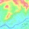
Ranipuram topographic map

Click on the map to display elevation.

About this map

Name: Ranipuram topographic map, elevation, terrain.

Location: Ranipuram, Vellarikkundu, Kasaragod, Kerala, India (12.39641 75.34398 12.43641 75.38398)

Average elevation: 662 m

Minimum elevation: 224 m

Maximum elevation: 1,104 m

Other topographic maps

Click on a map to view its topography, its elevation and its terrain.
Birikkulam

India > Kerala > Vellarikkundu > Nelliyara

Average elevation: 125 m

Vellarikundu

India > Kerala > Vellarikkundu > Kadumeni

Average elevation: 85 m

Birikkulam

India > Kerala > Vellarikkundu > Nelliyara

Average elevation: 125 m

Gear up for your next adventure:

🥾Hiking Shorts - Breathable shorts suitable for summer hikes
💡Portable Camping Lamp - Rechargeable lamp for campsite lighting
🥾Mountain Hiking Shoes - Shoes with superior grip for mountainous terrain
🧥Waterproof Pants - Keep dry during rainy hiking conditions
⛺Camping Essentials - All-in-one gear for a comfortable camping trip

As an Amazon Associate, this site earns from qualifying purchases at no extra cost to you.