Geolocate

Yvonand topographic map

Click on the map to display elevation.

About this map

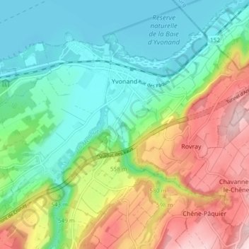
Name: Yvonand topographic map, elevation, terrain.

Location: Yvonand, District du Jura-Nord vaudois, Vaud, 1462, Switzerland (46.77012 6.70219 46.80868 6.77682)

Average elevation: 523 m

Minimum elevation: 421 m

Maximum elevation: 711 m

Other topographic maps

Click on a map to view its topography, its elevation and its terrain.

Gear up for your next adventure:

🔋Emergency Crank Radio - Weather alerts and power without needing batteries
🧰Multitool Knife - Compact and versatile tool for outdoor use
🧦Hiking Socks - Moisture-wicking and comfortable socks for long hikes
🪜Heavy Duty Carabiners - Multi-use clips for securing gear to your backpack
💧Hydration Pack - Hands-free hydration system for long hikes

As an Amazon Associate, this site earns from qualifying purchases at no extra cost to you.