
Thank you for supporting this site ❤️
Make a donation
Make a donation
Gear up for your next adventure:
As an Amazon Associate, this site earns from qualifying purchases at no extra cost to you.
Col topographic map
Click on the map to display elevation.
Thank you for supporting this site ❤️
Make a donation
Make a donation
Gear up for your next adventure:
As an Amazon Associate, this site earns from qualifying purchases at no extra cost to you.
About this map
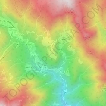
Name: Col topographic map, elevation, terrain.
Location: Col, Fusine, Val di Zoldo, Belluno, Veneto, 32012, Italië (46.35934 12.11399 46.39934 12.15399)
Average elevation: 1,484 m
Minimum elevation: 966 m
Maximum elevation: 2,006 m
Thank you for supporting this site ❤️
Make a donation
Make a donation
Gear up for your next adventure:
As an Amazon Associate, this site earns from qualifying purchases at no extra cost to you.