Geolocate

Ciriñuela topographic map

Click on the map to display elevation.

About this map

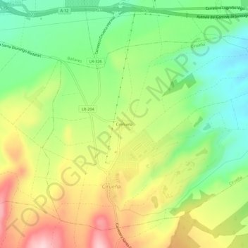
Name: Ciriñuela topographic map, elevation, terrain.

Location: Ciriñuela, Cirueña, Rioja, 26258, Spain (42.40179 -2.91271 42.44179 -2.87271)

Average elevation: 700 m

Minimum elevation: 598 m

Maximum elevation: 833 m

Gear up for your next adventure:

🥾Light Hiking Boots - Lightweight and comfortable boots for day hikes
🔨Vehicle Emergency Tool - Safety tool for remote road trips to trailheads
🛏️Sleeping Bag - Warm and compact sleeping bags for outdoor camping
🦶Anti-Blister Balm - Prevents friction and hotspots during long ascents
🥾Trail Hiking Socks - Comfortable socks to prevent blisters and fatigue

As an Amazon Associate, this site earns from qualifying purchases at no extra cost to you.