Geolocate

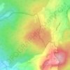
Stockhausen topographic map

Click on the map to display elevation.

About this map

Name: Stockhausen topographic map, elevation, terrain.

Location: Stockhausen, Herbstein, Vogelsbergkreis, Hesse, 36358, Germany (50.53200 9.37813 50.58122 9.49777)

Average elevation: 383 m

Minimum elevation: 254 m

Maximum elevation: 496 m

Other topographic maps

Click on a map to view its topography, its elevation and its terrain.

Schmitten

Germany > Hesse > Vogelsbergkreis > Sellnrod

Average elevation: 383 m

Dick

Germany > Hesse > Vogelsbergkreis

Average elevation: 378 m

Lauterbach

Germany > Hesse > Vogelsbergkreis

Average elevation: 361 m

Gear up for your next adventure:

🔭Outdoor Binoculars - Lightweight binoculars for birdwatching and hiking
🥘Camping Cookware Set - Compact nesting pots and pans for trail cooking
🚲Handlebar Phone Mount - View topographic-map.com live while cycling
🧶550 Survival Paracord - Versatile utility cord for emergency repairs and rigging
🪜Heavy Duty Carabiners - Multi-use clips for securing gear to your backpack

As an Amazon Associate, this site earns from qualifying purchases at no extra cost to you.