Geolocate

Munneru River topographic map

Click on the map to display elevation.

About this map
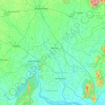
Name: Munneru River topographic map, elevation, terrain.

Location: Munneru River, Vatsavai, NTR District, Andhra Pradesh, India (16.59331 80.12207 17.30416 80.33019)

Average elevation: 94 m

Minimum elevation: 19 m

Maximum elevation: 671 m

Other topographic maps

Click on a map to view its topography, its elevation and its terrain.

Chityala

India > Andhra Pradesh > Vatsavai

Average elevation: 72 m

Gear up for your next adventure:

🥾Waterproof Hiking Shoes - Durable shoes for wet and rugged trails
🧼Travel Hand Sanitizer - Keep hands clean when water is scarce
🎒Backpack Rain Cover - External shield to keep your entire pack dry
👟Leg Gaiters - Keep debris, mud, and snow out of your boots
🧣Merino Neck Gaiter - Protects against wind, sun, and cold at high altitudes

As an Amazon Associate, this site earns from qualifying purchases at no extra cost to you.