Geolocate

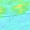
Suci topographic map

Click on the map to display elevation.

About this map

Name: Suci topographic map, elevation, terrain.

Location: Suci, Gresik, East Java, 61121, Indonesia (-7.16494 112.58156 -7.12494 112.62156)

Average elevation: 11 m

Minimum elevation: 1 m

Maximum elevation: 88 m

Other topographic maps

Click on a map to view its topography, its elevation and its terrain.

Sungai Desa Sumput

Indonesia > East Java > Gresik > Driyorejo

Average elevation: 17 m

Situs Giri Kedaton

Indonesia > East Java > Gresik > Gresik

Average elevation: 40 m

Gear up for your next adventure:

🥤Collapsible Travel Cup - Saves space and weight in your mess kit
⛺Backpacking Tent - Lightweight tent for long-distance hiking trips
❄️Traction Ice Cleats - Slip-on spikes for icy trails and winter hiking
🛶Canoe Life Vest - Safety vest for water sports
🧥Packable Rain Jacket - Breathable waterproof layer for unpredictable weather

As an Amazon Associate, this site earns from qualifying purchases at no extra cost to you.