Geolocate

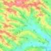
Courrensan topographic map

Click on the map to display elevation.

About this map
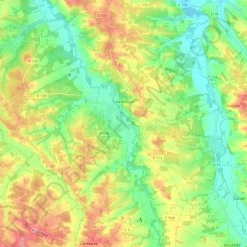
Name: Courrensan topographic map, elevation, terrain.

Location: Courrensan, Condom, Gers, Occitania, Metropolitan France, 32330, France (43.81338 0.17430 43.87042 0.29341)

Average elevation: 139 m

Minimum elevation: 87 m

Maximum elevation: 208 m

Other topographic maps

Click on a map to view its topography, its elevation and its terrain.

Le Tourmalet

France > Occitania > Gers > Saint-Pierre-d'Aubézies

Average elevation: 173 m

Tucon

France > Occitania > Gers > Gazax-et-Baccarisse > Gazax

Average elevation: 196 m

Gaugens

France > Occitania > Gers > Ordan-Larroque

Average elevation: 196 m

Lamaison

France > Occitania > Gers > Tournan

Average elevation: 250 m

Tucon

France > Occitania > Gers > Gazax-et-Baccarisse

Average elevation: 196 m

Loc

France > Occitania > Gers > Caupenne-d'Armagnac

Average elevation: 108 m

Balarin

France > Occitania > Gers > Montréal

Average elevation: 128 m

Gear up for your next adventure:

🥾Hiking Gaiters - Protect legs and shoes from mud, snow, and debris
🏃Hydration Running Vest - Carry water and maps close to your body for speed
🧦Outdoor Socks - Durable socks designed for hiking and outdoor sports
🧢Outdoor Visor - Breathable visor for sunny hikes
🧢Hiking Hat - Sun-protective and breathable hats for long treks

As an Amazon Associate, this site earns from qualifying purchases at no extra cost to you.