
Thank you for supporting this site ❤️
Make a donation
Make a donation
Gear up for your next adventure:
As an Amazon Associate, this site earns from qualifying purchases at no extra cost to you.
Bailo topographic map
Click on the map to display elevation.
Thank you for supporting this site ❤️
Make a donation
Make a donation
Gear up for your next adventure:
As an Amazon Associate, this site earns from qualifying purchases at no extra cost to you.
About this map
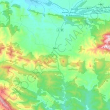
Name: Bailo topographic map, elevation, terrain.
Location: Bailo, La Jacetania, Huesca, Aragão, 22760, Espanha (42.42596 -0.89702 42.57477 -0.70233)
Average elevation: 816 m
Minimum elevation: 558 m
Maximum elevation: 1,534 m
Thank you for supporting this site ❤️
Make a donation
Make a donation
Gear up for your next adventure:
As an Amazon Associate, this site earns from qualifying purchases at no extra cost to you.